In the morning
sit down and weep
for a good day.
It will rise
and surround
and carry you
to places you cannot see.
Copyright Sandra Roe
In the morning
sit down and weep
for a good day.
It will rise
and surround
and carry you
to places you cannot see.
Copyright Sandra Roe
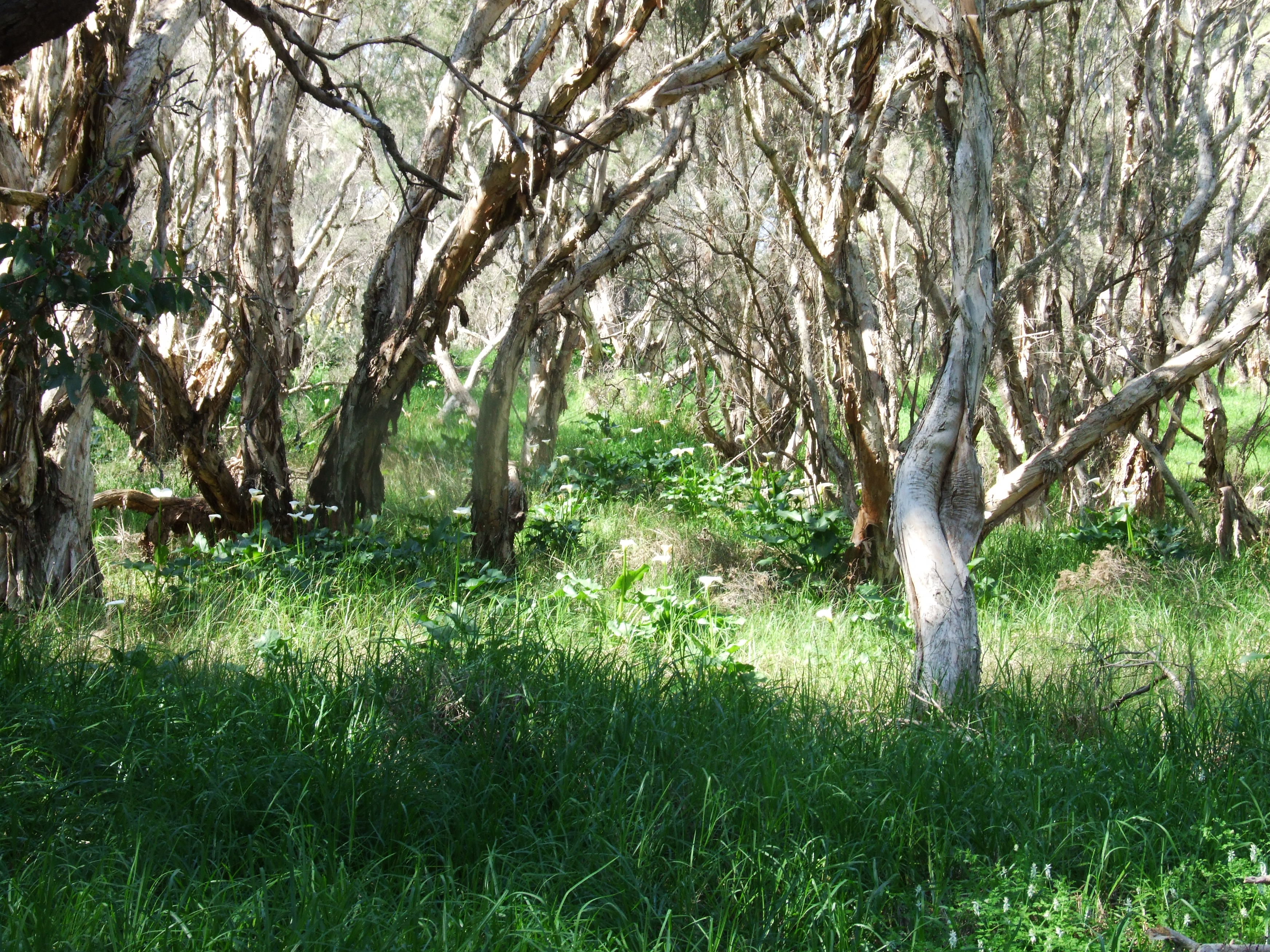
The Arum Lillies look pretty but they are a serious weed in south west Western Australia. Farming around Forrestdale Lake (about 25 km south of Perth) began in 1893, and in the 1920s sheep and cattle grazing took over from agriculture. During the 1940s the west side of the lake was heavily grazed by livestock, particularly during the dry summers when the lake’s fringing vegetation served as supplementary fodder. As a result, the land on the west side of the lake (pictured here) lacks native understorey plants and is infested with introduced plants such as these arum lillies.
Our university settled into the bushland
by the river
on the sandy coastal plain
and grew its treasures.
Winthrop Hall
laid the form
balconette and arches
porches colonnades
pitched terracotta roofs
and cordova tiles
harmony symmetry and restraint
carved out of local limestone
and sandstone
this Mediterranean pastiche
honouring ages past
and students present.
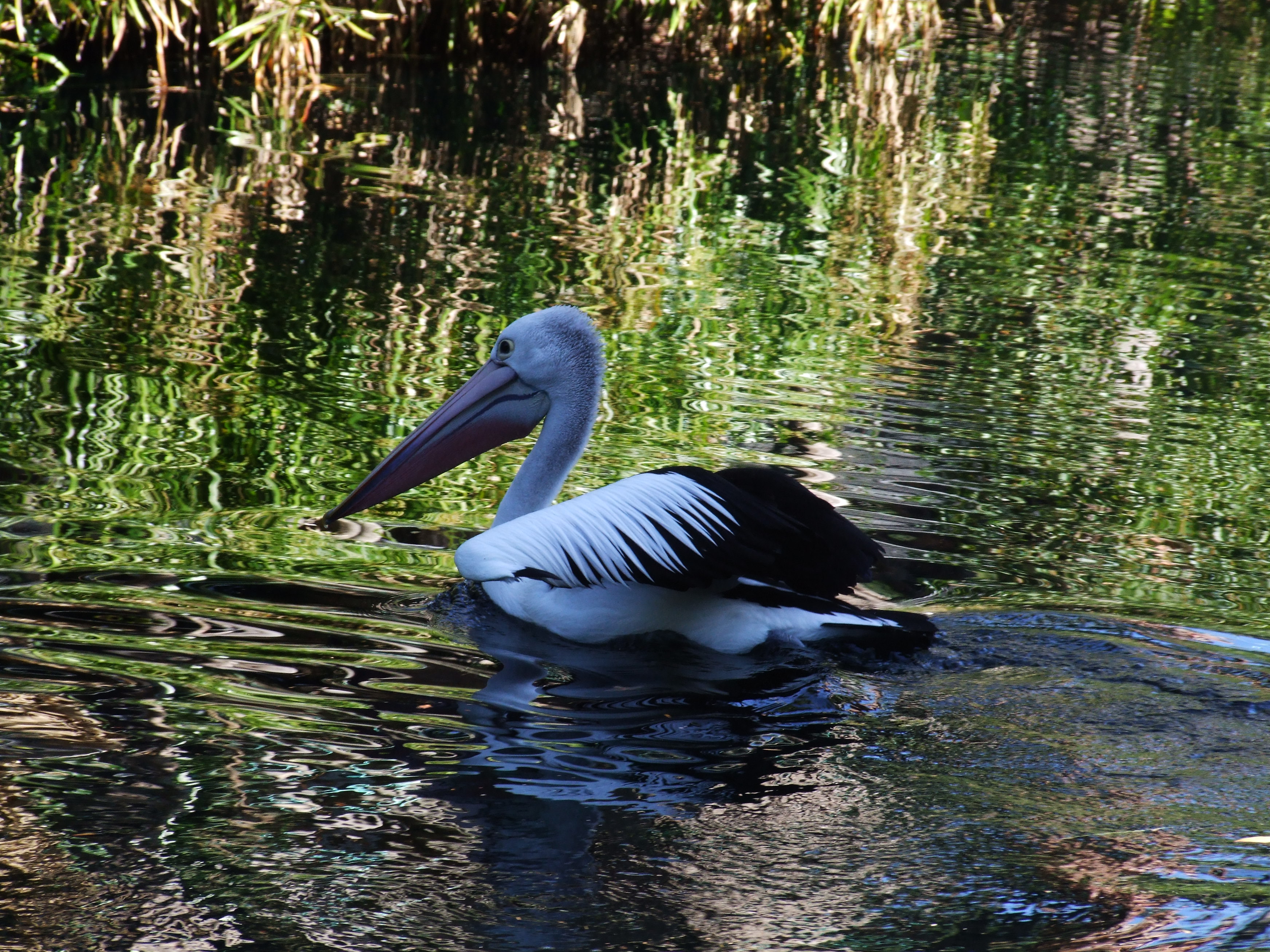
Rose window looks east to
watch pelicans on the river.
Reflection pond eyes the sky
for floating ducks.
Clocktower looks over forecourt
to highway north
and watches this
Australian Renaissance spread
line colour form and scale
south through gardens
open green spaces
libraries courtyards theatres
and faculty buildings.
Winthrop’s sand quarry
just west
is the Sunken Garden for
quiet hidden repose
entertainment and frolics.
Tropical Grove
south
waves trees and filters sunlight
onto birds and benches.
Great Court
campus inner realm
frames Reid Library
and its walkway
with lawns azaleas trees
moat with black ducks
and the occasional kookaburra.
Copyright Sandra Roe
Noongar fishing hunting
talking camping lighting fires.
Europe in boats
looking naming assessing
watching five hundred black swans
rising stirring wings
settling townships
bludgeoning black swans
while breeding and moulting
dumping refuse and sewage
into shallows
setting the brewery by the river
for water and transport
and dumping waste
reshaping the river
against flooding
for boat access
and more dry land
for cropping and building
removing the mouth’s rocky bar
making the harbour
the estuary more salty
building retaining walls
reducing shallow habitat
pouring scum and ooze
from the power station
reclaiming more land
for the freeway and interchange
ongoing community action
cleaning and conservation
retaining some pockets of original vegetation
fringing forest, salt marshes and rushes
banning bird shooting
establishing swanneries
restoring the icon
all waterbirds are now remaining
if reduced in number
three habitats for wading birds
Milyu
Point Waylen at Alfred Cove
and Pelican Point.
Copyright Sandra Roe
Remnants of ancient rivers
chains of salt lakes
remain beyond the Darling Range.
The Avon
a new river
left the raised Yilgarn Plateau
and fell into the rifted valley
to become the Swan
flowed onto the coastal plain
carved out Perth Canyon
the broad deep abyss
now out there
and the sea level moved and moved
back and forth
until at last
Rottnest became the Island
and the sea water
drowned the scoured river valley
to form the Swan River estuary.
Copyright Sandra Roe